Featured Projects
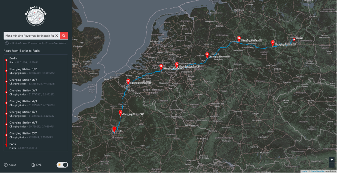
Geo Data Search
2 years agoA browser app that enables users to search for routes and places specified by geographical properties, like height of elevations and route lengths. The user-friendly interface allows processing of queries expressed with natural language. The results are shown on a map and can also be exported via the downloadable KML file. Moreover, the app comes with features including finding charging stations on routes, as well as cost-saving route planning by avoiding toll roads.
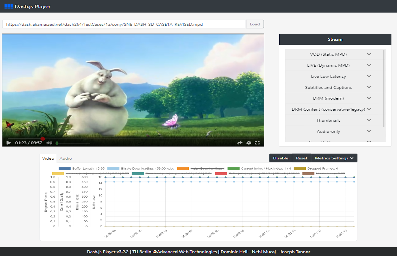
Dash.js Player
3 years agoIn the scope of the Advanced Web Technologies project at the Open Distributed Systems group at the Technical University of Berlin, we developed a powerful video and audio player that is able to play DASH content. The main technologies we used to develop our user interface are dash.js, an open source JavaScript framework that enables building video players, React.js, a library that can be used to create interactive user interfaces, as well as Chart.js, a library we used to create live charts for metrics like latency and buffer level.
Opensense.network Refactoring
4 years agoOpenSense.network is designed to collect open data from diverse sources, including traditional environmental sensing networks like the German national weather service "Deutscher Wetterdienst", as well as participatory sensing platforms and communities such as "luftdaten.info". Our task was to migrate the Opensense.network API interface from a monolith to a function-as-a-service system.
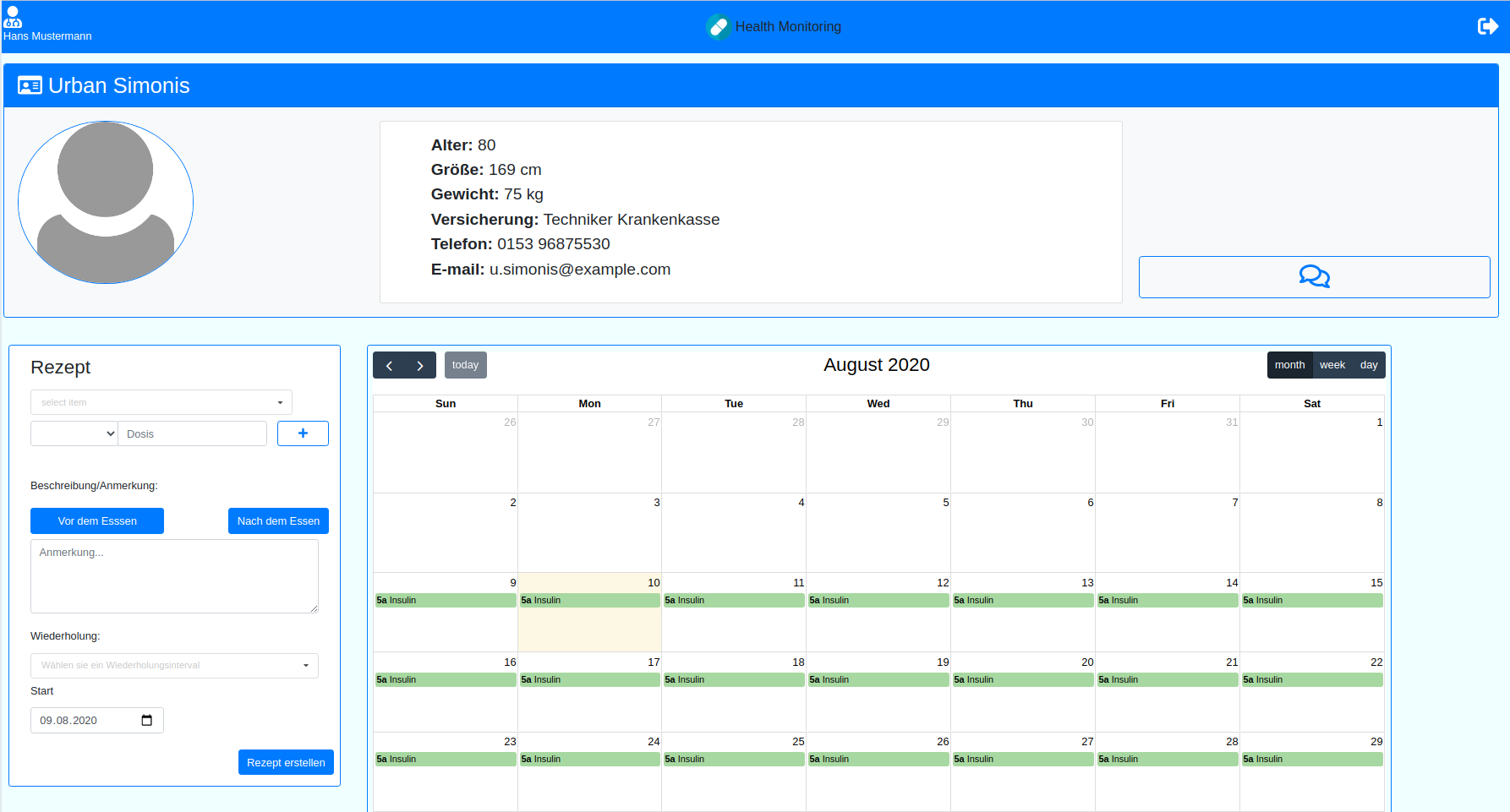
HealthMonitoring
4 years agoThe HealthMonitoring app enables patients to actively track medication adherence and vital parameters. We developed a web interface that allows doctors to access and update patient prescription plans from a central database. The app also provides detailed patient information, communication with patients via chat, and tracking of medication intakes.